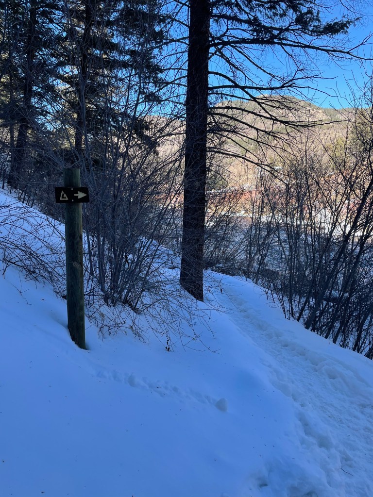
I got back on my snowboard for the first time in two years. Like riding a bike, my brain and body remembered the skills after a few runs. I didn’t feel comfortable, though, and nearly caught an edge multiple times. After three or four runs, I still wasn’t really having fun. If it had been a powder day, or warmer temperatures, that might have changed things, but the snow was crunchy (thankfully not icy) and the weather was quite cold.
Then I put in my earbuds and turned on Dave Matthews ‘Live at Redrocks’ album. I guess it was just enough distraction – I could no longer hear the snow crunching beneath my board, and a portion of my brain was keyed into the music – that it took the edge off. Each run after that was far more relaxed, which of course improved my riding, which of course made everything more fun.
Sometimes a distraction is just the thing.
By the way, the NB bus from Boulder to Eldora is my new preferred method for getting up there. No concerns with parking, no hiking across parking lots carrying gear. The bus drops off and picks up right in front of the Alpenglow lift, and it was super easy and comfortable. Buses every 2 hours each direction. If you’re headed to Eldora, definitely check it out.
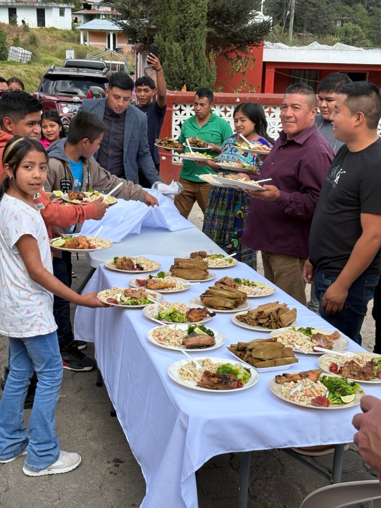
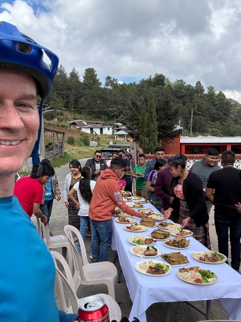
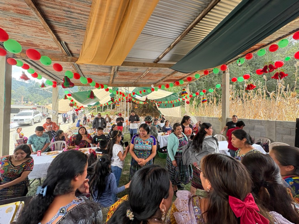
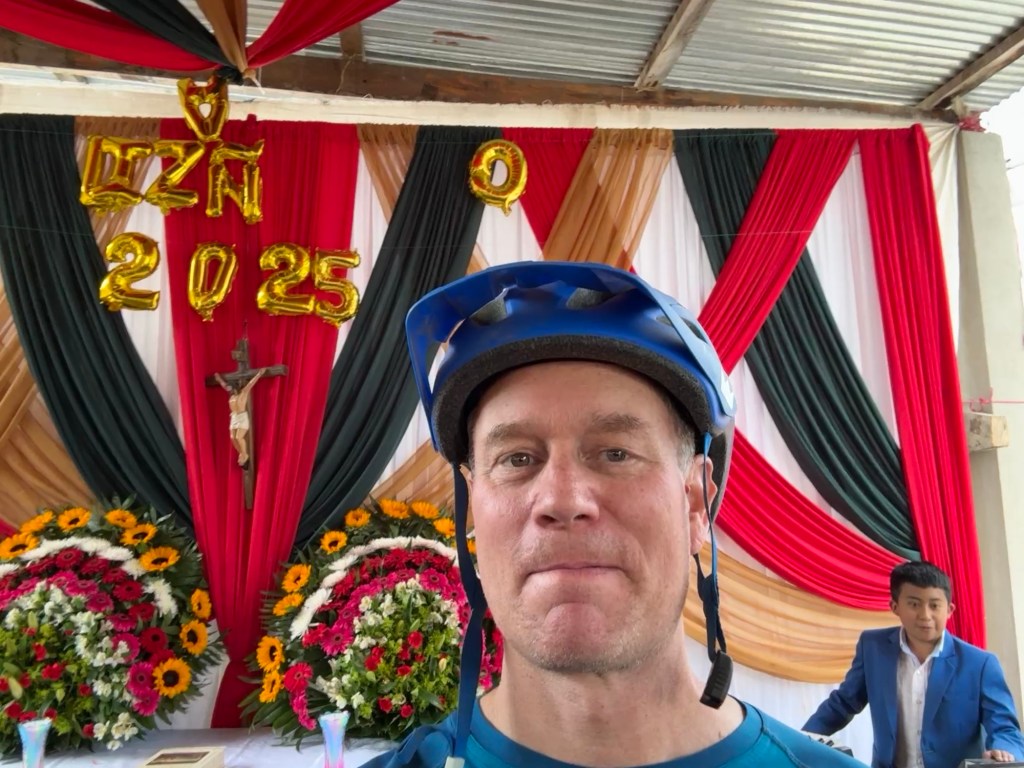
An hour or two into our mountain bike tour, the route took us up a hill into a rural Guatemalan village. Nothing unusual about that, but the village was having a party. Large tents, maybe 100 people, and a full band playing Christmas carols. We learned that one of the families in town had had a prosperous year and was treating the town to a party. That was pretty cool all on its own, but one of us expected what happened next.
When the host of the party learned we were touring the area on bikes, he insisted we join in the celebration and invited us to sit down for lunch. Our tour leader, Brendon, initially declined but they pressed until he accepted. It was unbelievable how quickly tables and tablecloths and chairs appeared. They set up a spot for us – a group of 10 bike riders! – right there on the road. Plates of food magically appeared, and we sat and rested and ate and celebrated with the village. It was amazing that we arrived just exactly at that moment, and even more amazing they invited us to their feast. They could have simply smiled and given us a friendly wave. You can’t make this stuff up, and I’m now convinced the Guatemalan people are the friendliest on earth.
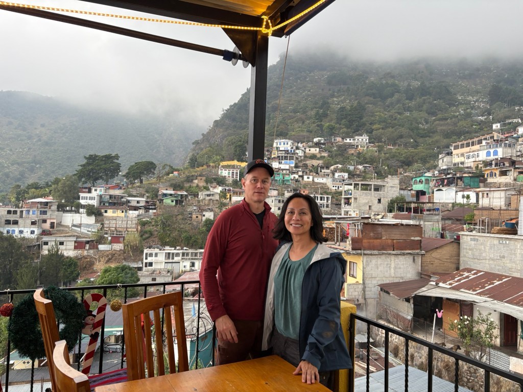
We went to Guatemala! Michelle and I had a wonderful trip filled with learning, adventure, new foods, making new friends, and strengthening our relationship. Now on the flight home I’m taking some time to capture our day-by-day activities, mainly so we can remember what we did!
We arrived on Christmas Day 2024 and spent three nights in Antigua, Guatemala followed by three nights in Panajachel, Guatemala for a total of six nights. We returned to Colorado on New Year’s Eve.
DAY 1: Wednesday 12/25 – Travel day
Boulder>Denver>Houston>Guatemala City>Antigua.
Highlights: Dinner at Arrin Cuan. We found this by walking around the neighborhood, and stopping in any place that was open on Christmas. Our first taste of Guatemalan food. Delicious, rich flavors and mainly meat-based dishes.
Lowlights: None! No hiccups in our travel day.
DAY 2: Thursday 12/26 – A day touring Antigua
Highlights:
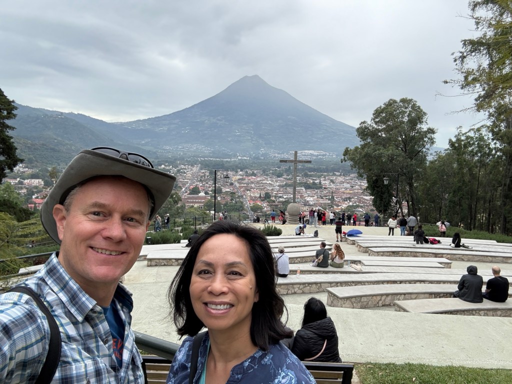
Cerro de la Cruz. Great way to start the day with a view from a terraced public park above the city.
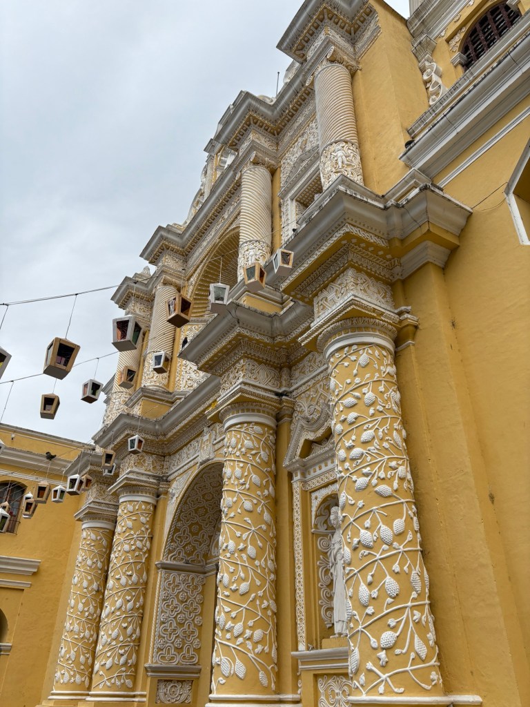
Eruption of Fuego Volcano. We took this video from the rooftop of Iglesia de la Merced, another church that we toured (Q35 entrance fee*).
Iglesia de La Merced
Vulcan Fuego spewing
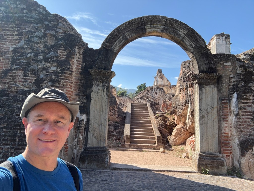
Convento la Recoleccion Ruins. This was once a Catholic church and monastery. After the Q40 entrance fee*, you can walk and scramble over the ruins. There are super cool octagonal windows still intact – but check out those cracks!
Ruins at Convento La Recoleccion
* One U.S. dollar is about 7.5-8 Guatemalan Quetzal (GTQ). So Q40 is about $5-6.
Dinner at Hector’s Bistro. We had read about this place in multiple guidebooks, and it was worth seeking it out. Delicious French food. We met a mother/daughter on the plane from Houston. Turned out they were our neighbors at the hotel. And they had dinner at Hectors the same night as us. We sent them a surprise dessert.
Lowlights:
All the cobblestone streets did a great job slowing down the cars. But they also worked our feet, especially Michelle’s.
The ruins at Convento la Recoleccion smelled of urine. Yuck.
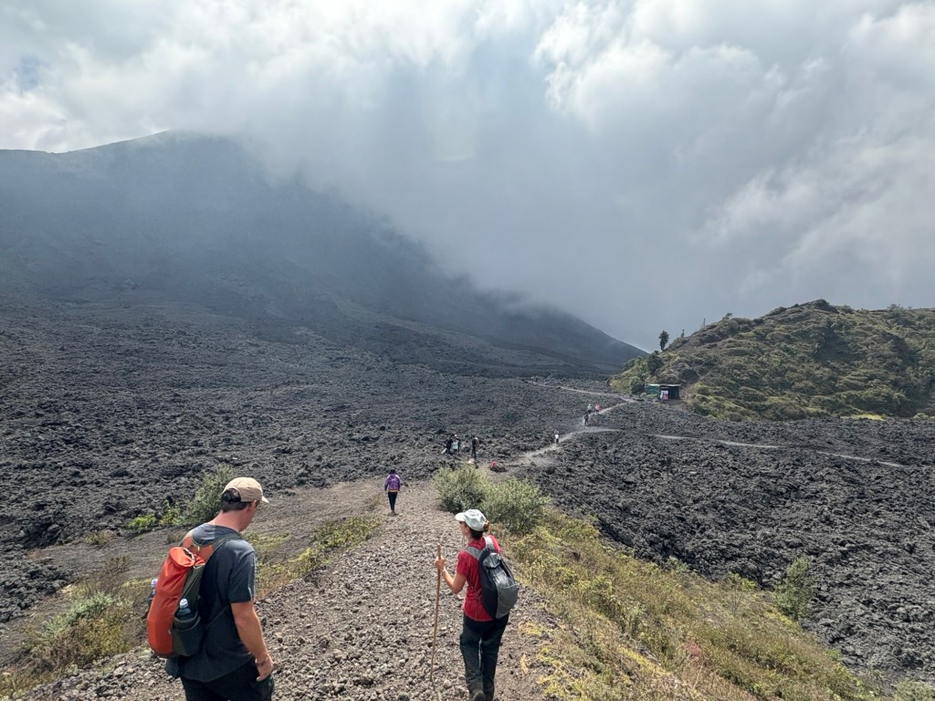
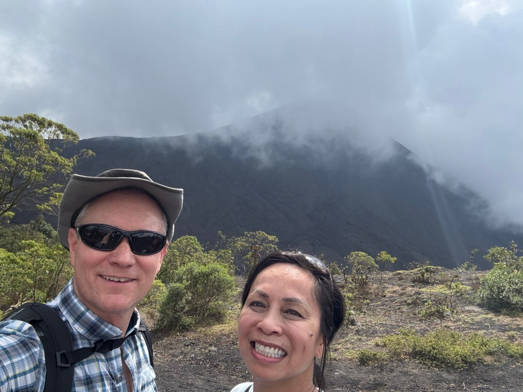
DAY 3: Friday 12/27 – Hike a Volcano
We wanted to do some more adventurous hiking, but we didn’t realize how popular the guided hikes were, especially at this time of year which is the busiest for the tour operators. We lucked out with a last-minute cancellation for a hike on Vulcan Pacaya. While the hiking was less extreme than other volcanoes in the area, Pacaya is still an active volcano and we were able to visit one of its lava fields.
Highlights:
‘Skiing’ down the mountainside. The ashen rock was so powdery! Check out Michelle’s dusty footsteps. Kind of reminds me of PigPen from the Peanuts.
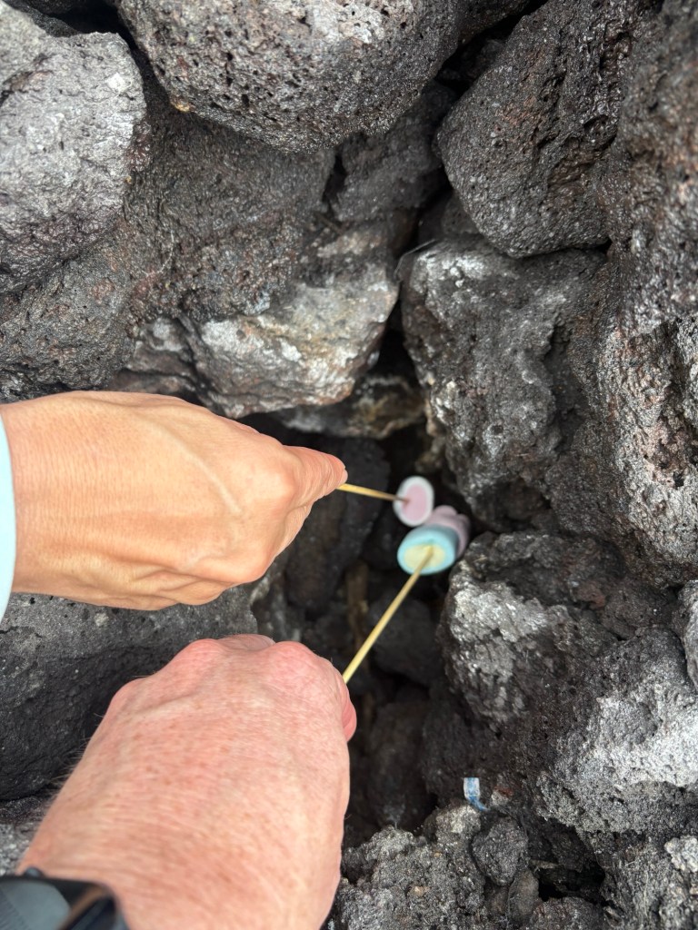
Roasting marshmallows over the vents in the lava field. The lava field was formed in the 1976 eruption. It was plenty cool to tread upon, but there were a number of shafts down into the rock where steam was escaping. The steam was hot enough to be uncomfortable on my hand, and it was enough to roast a marshmallow! (The tour guides were ready.)
Lava fields below Vulcan PacayaRoasting marshmallows in a steam vent
After the tour (and after a shower), we finished the day with a tasty local meal from a tiny restaurant around the corner from our hotel. The place is called Delicias de Abuelita which translates to Granny’s Delights. This was basically street food (home-made) with a small indoor seating area. We sampled everything on the menu! My favorite was the rellenitos and Michelle liked the doblatas.
Lowlights:
There was an hour-long van ride to the start of the volcano hike. The driving was fine, but we shared the van with a California family – friendly parents but their kids (adult kids, actually) were awful, awful awful!
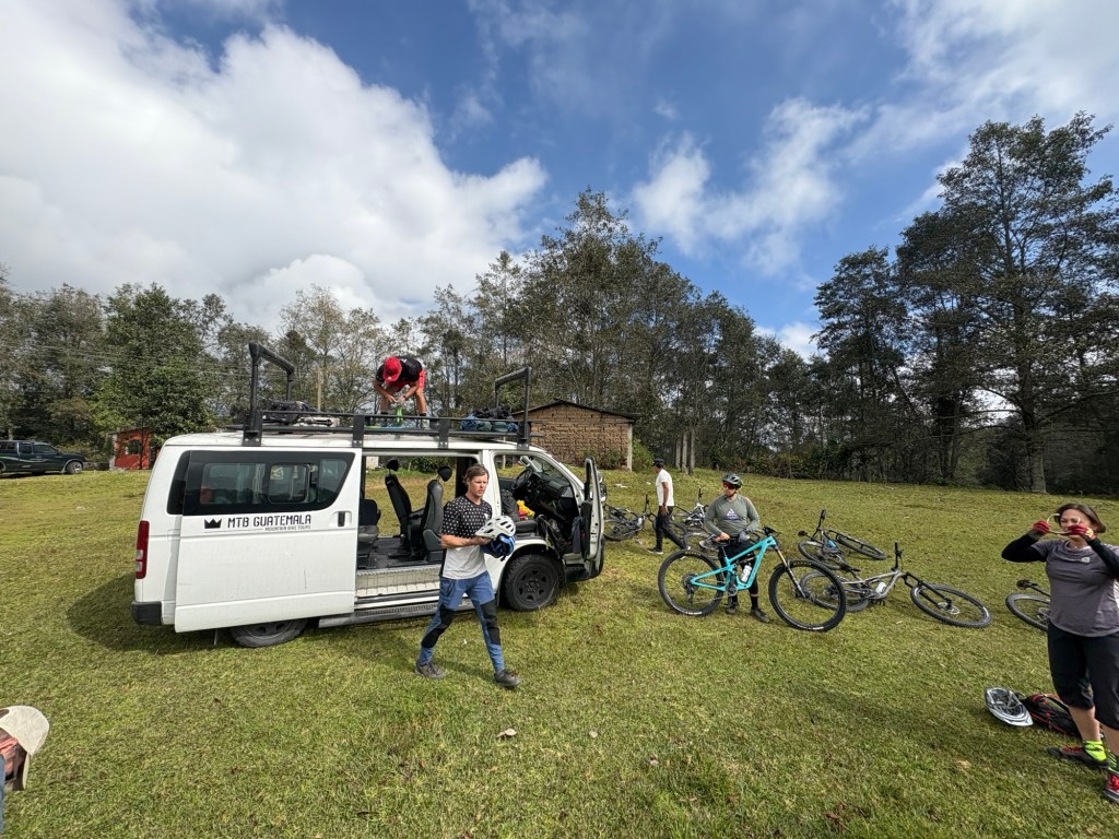
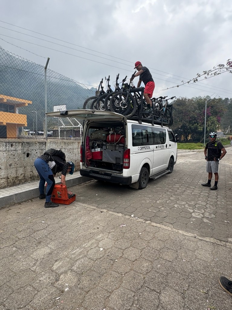
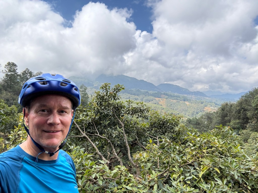
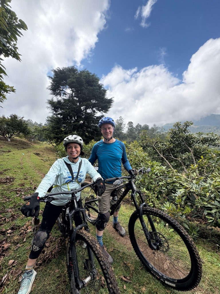
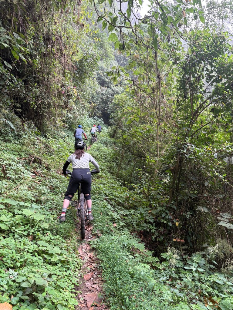
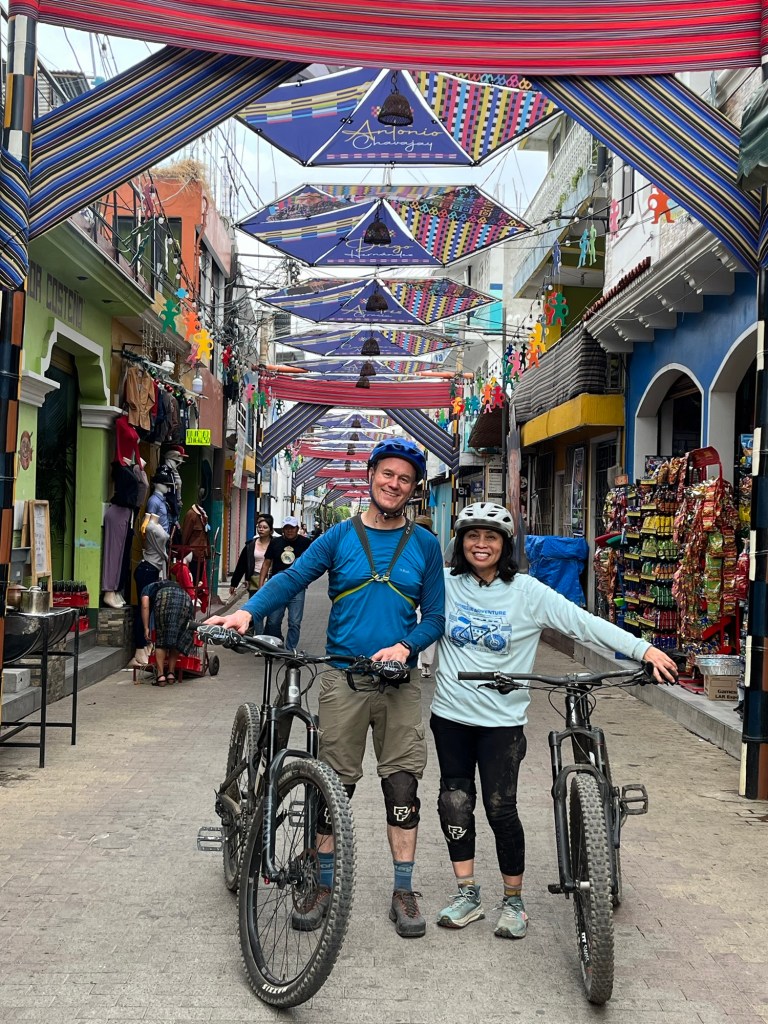
DAY 4: Sat 12/28 – Mountain Bike around Lake Atitlán
Many highlights from this bike ride – too many too list. We booked our tour through MTB Guatemala. This is a fantastic, professional operation and we totally lucked into it with a last minute sign-up. Brendon (owner and tour guide) worked hard to ensure all the logistics ran smoothly, the equipment was in good shape, and he and Oscar were very conscientious guides. We learned a lot about Guatemala in general and the region specifically. Very highly recommended – we will tour with Brendon again if we can!
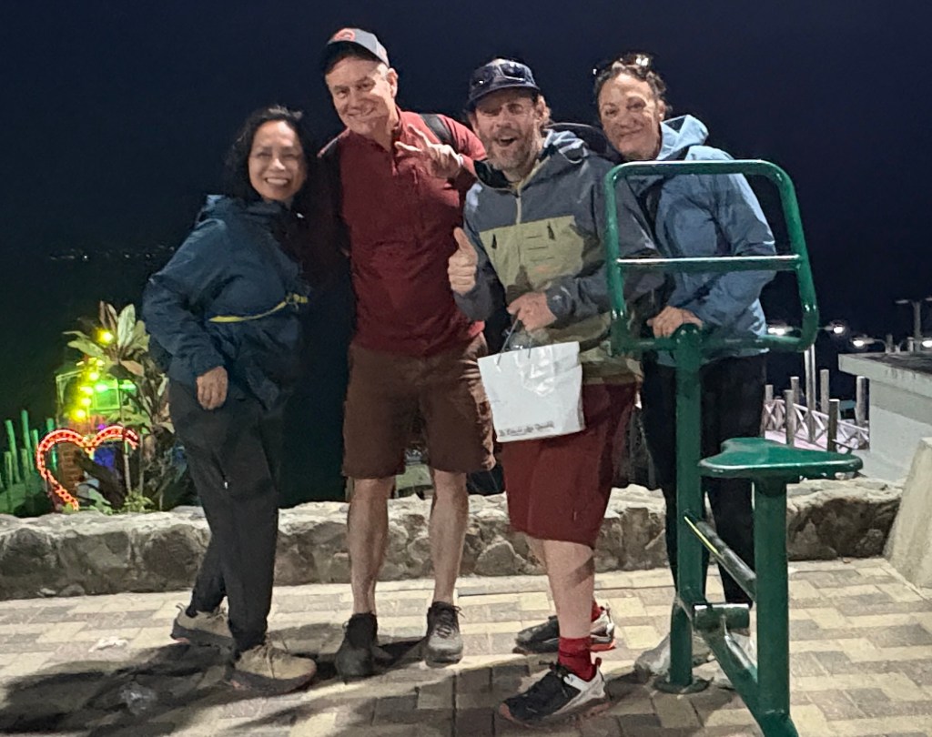
Highlight of the trip! Unplanned lunch with local townspeople. This was an awesome experience, something you can’t ever plan, and only happens a few times, if ever, in a lifetime. I wrote a separate post just about this. (Link to Guatemala Part 2 – Village Celebration) This was one of my favorite moments of 2024. Really cool.
Some mountain biking photos:
Lowlights:
None! What an amazing day!
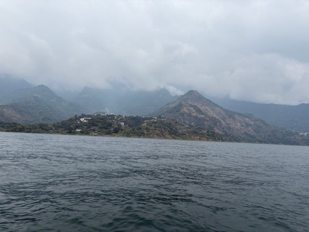
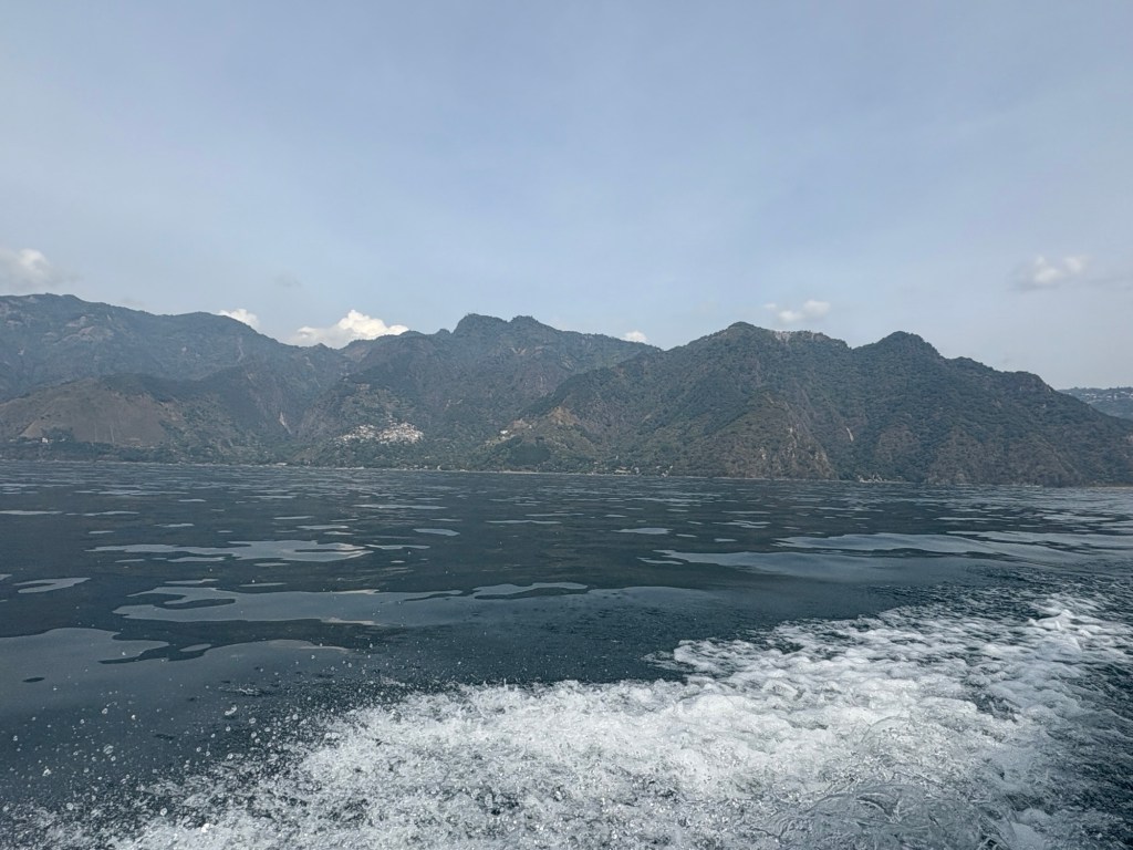
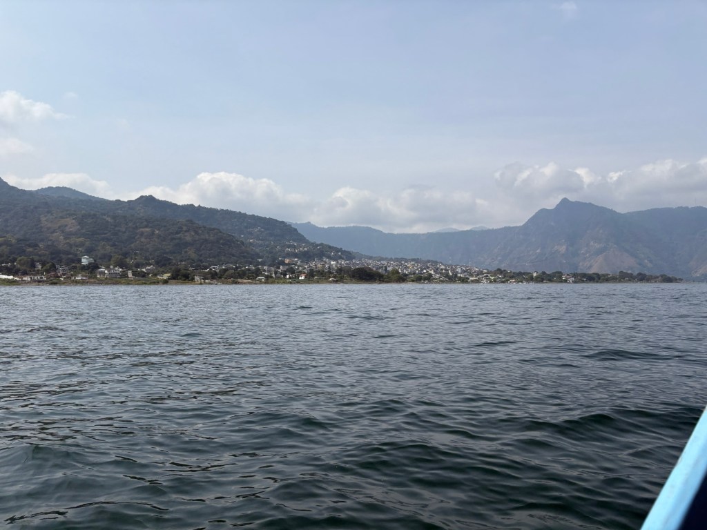
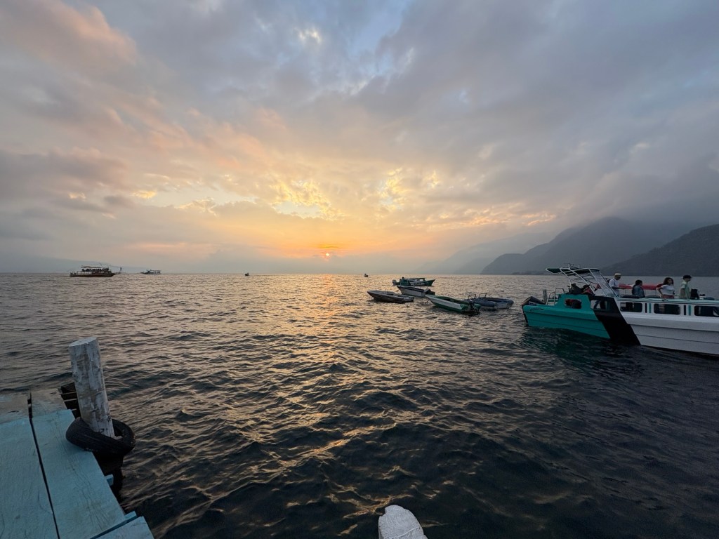
DAY 5: Sun 12/29 – Boat tour of Lake Atitlán and its waterside towns
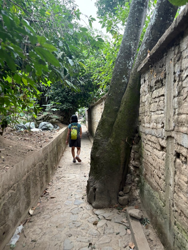
The lake is surrounded by many villages in which the Maya culture is still present and traditional dress is worn. We had made friends with another couple on the mountain bike tour, and we split the cost hiring a private boat for the day. We visited four towns: Santiago, San Juan, San Marcos, Santa Cruz.
Highlights:
It was fun having other people to connect with. Scott and Jules are from Golden … just a few miles from Boulder! They’re fun, easy-going people and it made for an enjoyable day of shopping and exploring the little towns around the lake.
With Scott and Jules
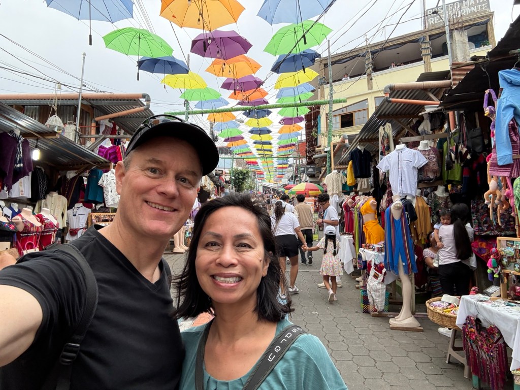
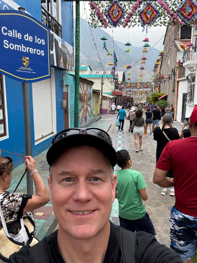
San Juan is a super colorful city. If there was a race with the other lake-shore towns to win the most tourist dollars, San Jaun has won it by painting Instagram-able murals, banners, and other beautiful engaging decorations throughout the town. Loads of people everywhere. Here is a photo of the main tourist road. Cool umbrellas!
Colorful
Views from the Boat
Lowlights:
San Marcos could have been a much nicer town. Seems like the hippies are too permissive about the dogs – there is literally dog $h!t everywhere. Disgusting. Also, the town is known as a spiritual destination, with yoga and meditation and massage. However from what we could see, all these places were behind closed or locked doors, as if they wanted to keep the riff-raff out. Maybe they need to do so, but it left an impression like the gringos had taken the town away from the locals.
DAY 6: Mon 12/30 – Rest and relax in Panajachel
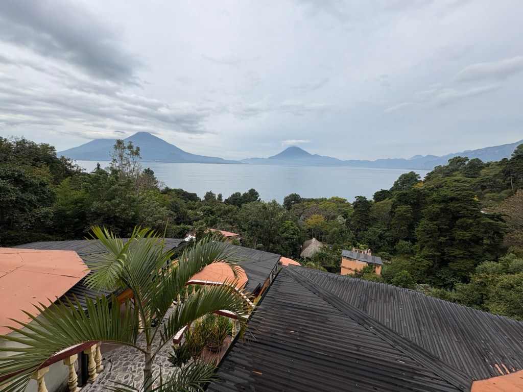
After five days of exploring, we enjoyed a day of R&R hanging at our beautiful Bed & Breakfast, called Jenna’s River B&B. It’s located a few hundred feet above the lake, looking out across the water toward two of the volcanoes that ring the lake. We slept in, had a late breakfast, read our books, journeyed into town for a few hours (there is a great museum where we learned a lot about the history and the geology of the region), and packed up for tomorrow’s long travel day.
Lake View from Jenna’s
Highlights:
The museum in Panajachel is small but worth a visit.
Meals at Jenna’s are a home-made affair.
Lowlights:
We wanted to find a nice restaurant in town, but most of the places we saw were tourist-oriented. We settled for another dinner at Jenna’s which was once again delicious.
DAY 7: Tues 12/31 – Travel day
Panajachel>Guatemala City>Houston>Denver>Boulder
Another fairly easy travel day. The flight from Houston>Denver was delayed but not terribly so. The roads surrounding Denver Airport were iced over which made for some white-knuckle driving, but the ice relented as we moved closer to Boulder, and we arrive home safely.
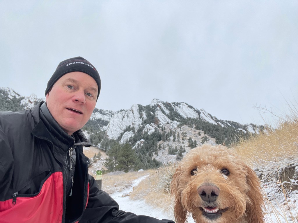
Sometimes it’s just right. This morning’s hike was supposed to be with another friend on a different trail, but when they canceled last minute I headed up toward NCAR with Cricket the endlessly effervescent pup. I randomly bumped into my friend Swavek. (What are the chances? If he’d reached that trail junction 15 seconds earlier we would have missed each other). We hatched a plan to run a trail relay next year. Just need to find 8 more people for our 10 person team!
I love the Boulder mountain trails under fresh snow. Not many people out this morning – maybe it was too cold. But for me and Cricket and Swavek it was just right.
One night after work last summer, I joined my friend Leo for a mountain bike ride up Hall Ranch. Leo is a much stronger and more experienced rider than I am, but he’s also very kind and he never seems to mind riding with me even though he has to downshift several levels for us to stay together.
Unfortunately, the trailhead for the ‘easy’ route at Hall was full. To my chagrin, Leo suggested we head around to the main trailhead, which meant riding up (and down) the infamous Rock Garden.
I found myself battling fear. To understand why, go check that link above.
We rode up this technical section (frequently hike-a-bike for me) and then spent an hour on the beautiful flowing single track trail up on the mesa. Leo’s advice during the uphill and around the mesa was, “practice different skills even when you don’t need them.” He wanted me to develop experience and some muscle memory that could help later when I needed them.
I took Leo’s advice with a surprising result – I actually rode most of the way down! (Slowly!) And I did walk a few sections. But the real consequence of Leo’s guidance was increased confidence, satisfaction, enjoyment, and sense of accomplishment. That, and heavy use of the seat drop feature on my bike.
I recently re-read an old post The Rapture of Being Alive and decided to capture moments of rapture from the past week. For me, experiences of rapture are more than just feel-good moments – they are experiences that open us up, they invite vulnerability, and they make us more freely available to others.
From the past 7 days…
I felt it with Michelle yesterday, as we got deep into conversation about kids and sports and cell phones and growing up.
I felt it when I texted Dad about the Chaos Walking movie.
I felt it last weekend when Joe and Jack and I were climbing in Boulder Canyon.
I felt it with Quinn at the coffee shop this week, talking about the photography on the walls.
I felt it with Luca this morning, hiking up to the Royal Arch in Boulder, discussing career and friendship and spooky tales of haunted houses.
I felt it last week at lunch with the CFO/COO of the Colorado Mountain Club. Jacob shared some inspiring mountaineering stories, interspersed with business challenges they’re tackling at CMC.
I even felt it playing fetch with the dog, and tug-of-war with a rag.
These are older than 7 days…
I feel it on every exec hike with Geoff.
I feel it every time the Zen Mustache crew takes the stage for a performance. And any time we get together to play music, even if it’s just in the garage.
I felt it riding my bike on paths through the nature preserves south of Chicago.
I felt it camping by myself in the back of the truck, listening to insects chirping and the wind in the forest.
I felt it laying flooring at my parent’s house, crawling around on my knees, moving appliances, and listening to country music.
Looking at the list above, trying to extract what’s in common. It’s not about the specific activity. Seems that rapture comes from two places:
It’s about who I’m with and the openness of that relationship, or:
It’s about being open to the moment at hand and immersing completely in the experience – not worried about other things – so the focus is completely present.
Those are moments of rapture, and it turns out they are everywhere.
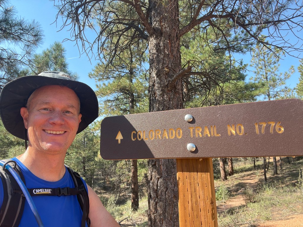
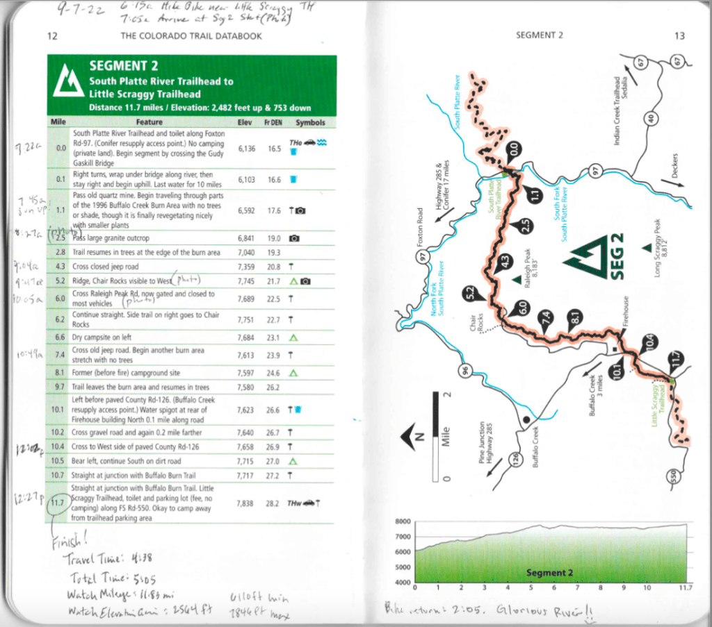
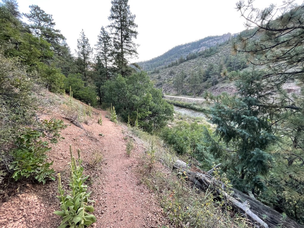
I’ve been scoping out the Colorado Trail for many months with the idea of hiking & biking one segment at a time. This week I took my first steps toward completing the 486-mile CT as I tackled Segment 2. Now I know you’re asking, “What about Segment 1?” I chose to start with Segment 2 because among the segments nearest to Boulder, it’s the shortest (12 miles each way) with the least elevation gain (2,500 feet). It was a place to test myself and rediscover how well I function on bigger day-long outings. It’s been at least 7 years since I tried anything like this distance/elevation and I wasn’t sure what to expect from my body, which is not getting younger. Thankfully, all my parts held together. I took breaks, brought plenty of calories to maintain energy, and slowed down my pace to take pleasure in the experience. I was very tired by the end but I loved the whole thing: following an amazing trail through incredible changing scenery.
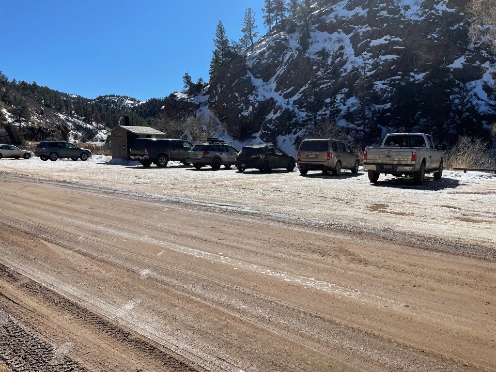
I started early, leaving Boulder at 5am and driving my truck to the other end of the trail (my turnaround point) arriving at dawn, with just enough light to find a hiding place in the woods to secure my mountain bike. With the bike stashed, I jumped back in the truck and navigated the dirt roads that took me to the start of Segment 2, located near the confluence of North and South forks of the South Platte River. I began hiking a little after 7am.
Conditions were HOT, above 90 degrees from 11am onward. I brought over 140 ounces of water (36 oz in a Nalgene bottle stashed with my bike at the turnaround point, so I didn’t have to carry all the water all the way). By day’s end I drank all but about 16 oz.
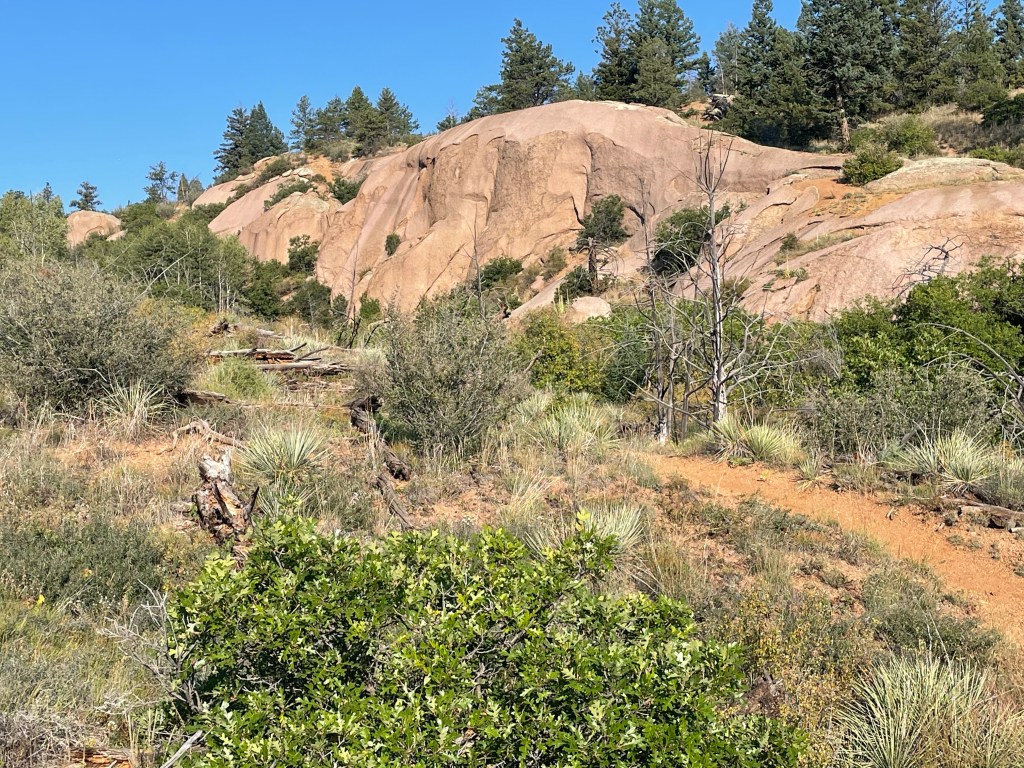
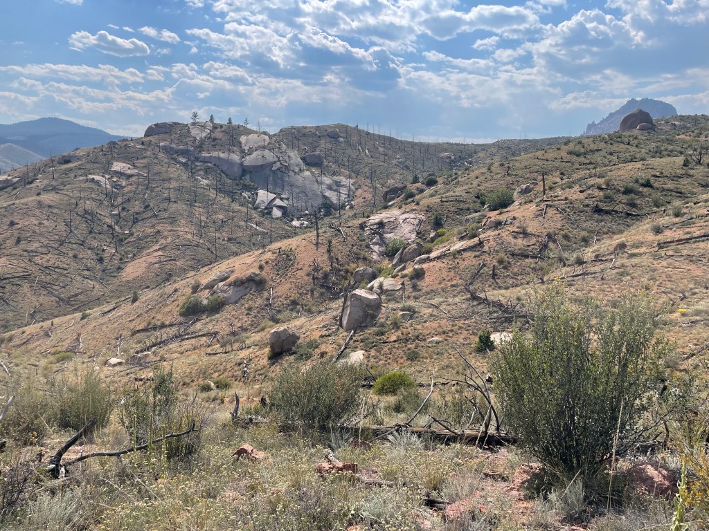
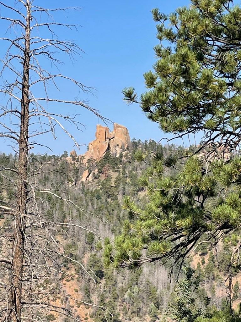
Large granite outcrop. It extend for about 1/3 mile. The trail curved to the right and traversed the top of the outcrop.
I don’t know if it was the time of year or that I was out there on a Wednesday but I saw virtually no one on the trail all day. In one sense it was invigorating to feel so alone and remote, but I was also found the experience startlingly eerie. Maybe I just need to get reacquainted with being alone in the wilderness. I saw one couple on their bikes at mile 8; one woman on her bike at my turn-around point at the Little Scraggy trailhead; and that was it for 5 hours hiking and 2 hours biking. At the very end, when I got back to my start point, I saw about a half dozen hikers in two separate parties who were just getting started on Segment 2. I believe trail magic is a real thing, but it requires other people and was not available this particular day.
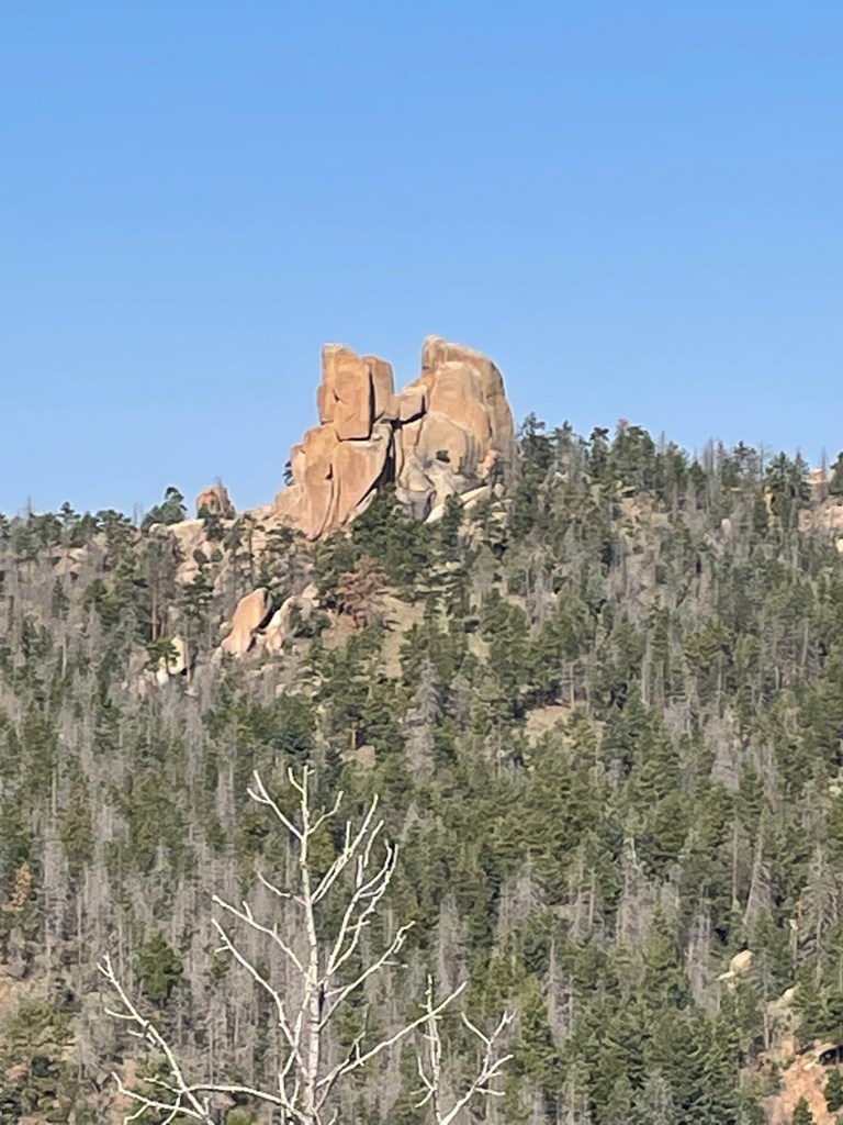
This formation is called Chair Rocks. I had the views all to myself.
Stats
Sept 7, 2022
East-to-West (hike)
West-to-East (bike)
Distance
11.7 miles
11.7 miles
Elevation Gain
2,564 feet
806 feet
Moving Time
4:38
2:05
Total Time
5:05
2:14
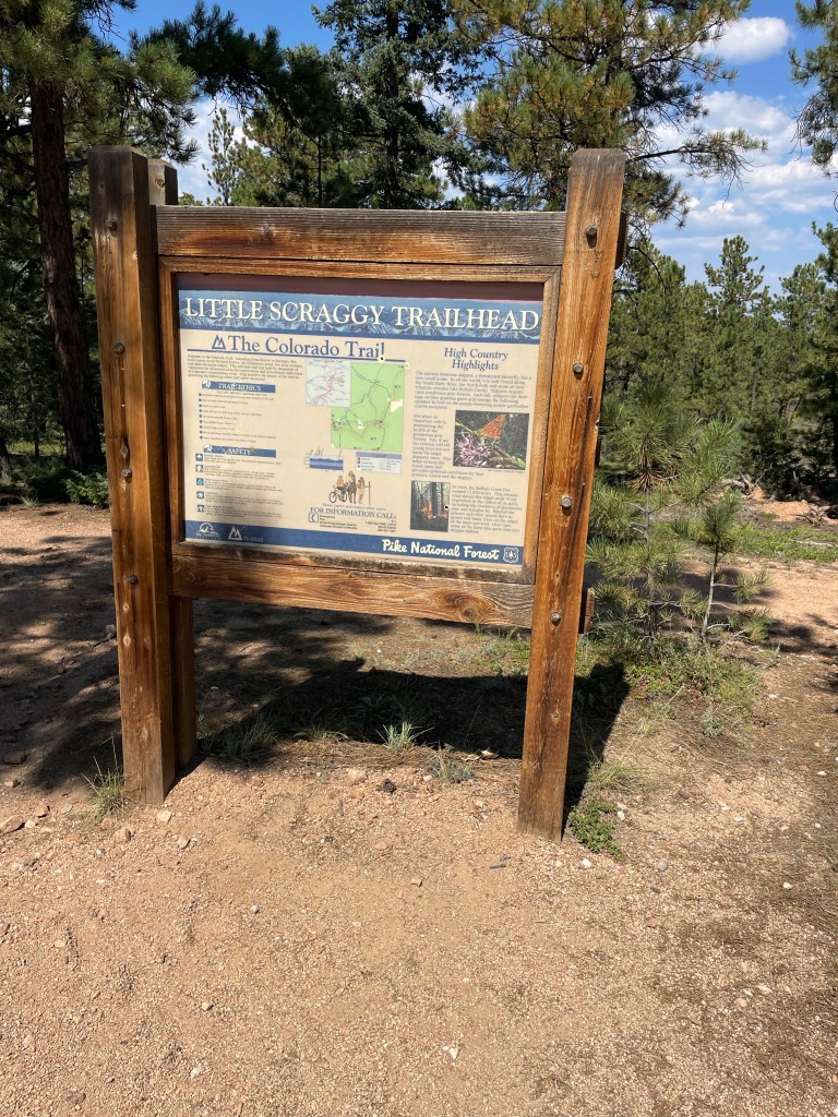
Stats: CT Segment 2 — South Platte River Trailhead to Little Scraggy Trailhead
My field notes
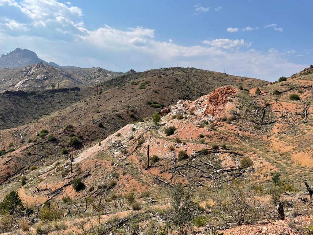
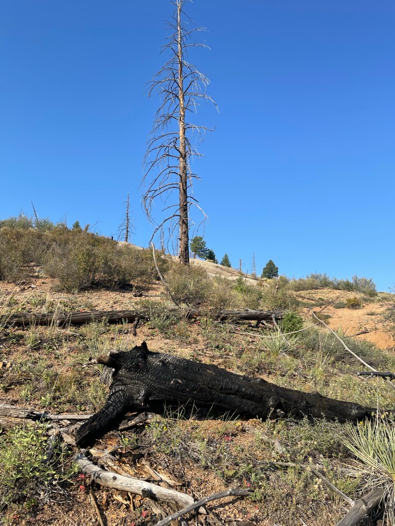
Fire and Scars
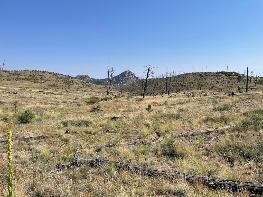
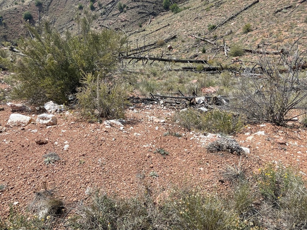
In May 1996 a human-induced fire burned nearly 12,000 acres of the Pike National Forest, including most of the western half of Segment 2. The fire torched a campground that had been located here, and it dramatically changed the character of the landscape. Once a walk through a pleasant pine forest, today large sections of Segment 2 have expansive views, but no shade. Now 26 years later the forest still has a long way to go. These areas are revegetating with small grasses and plants, and I did see some new young pine trees in lower-lying places. I’m not a forester, but my guess is it’ll be at least another century before this place begins to feel like a forest again.
Burn scars remain from the fire 26 years ago.
What I Liked Best About Segment 2
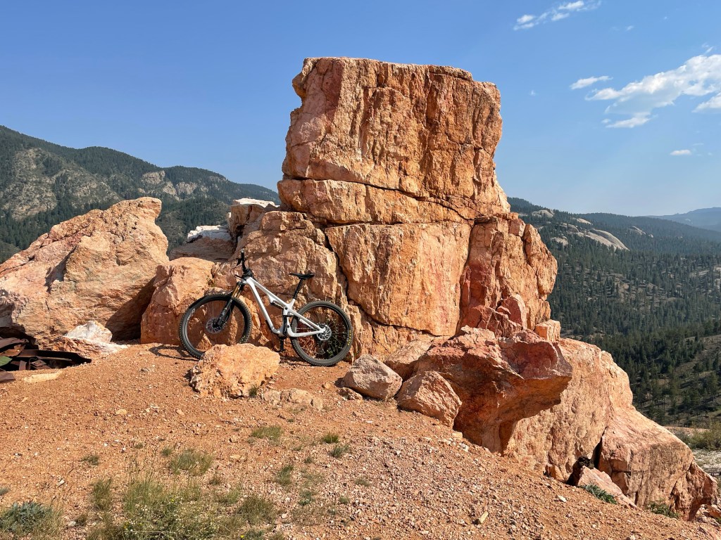
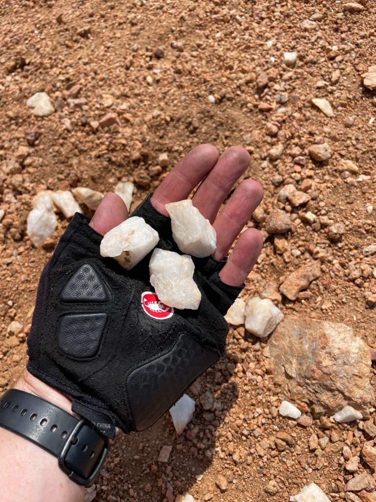
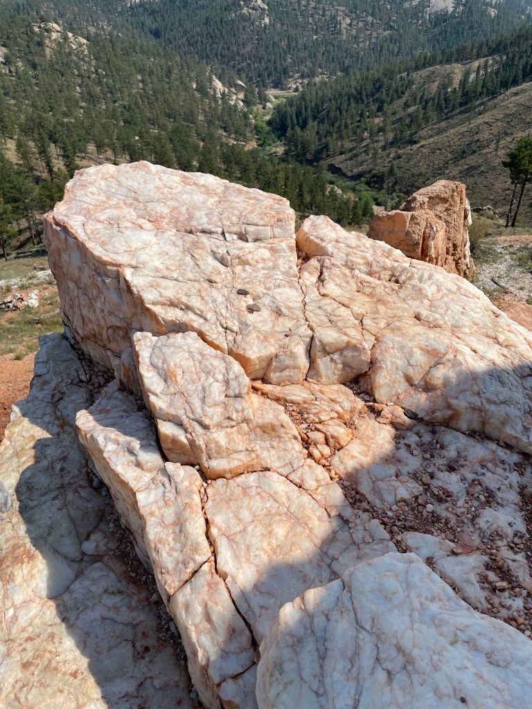
Quartz Stones. One section of the trail passes an old quartz mine. Parts of the trail was littered with pink and white stones. Totally unexpected and beautiful.
This was a neat spot for a breatherPretty
What I Liked Best: Close Runner-Up
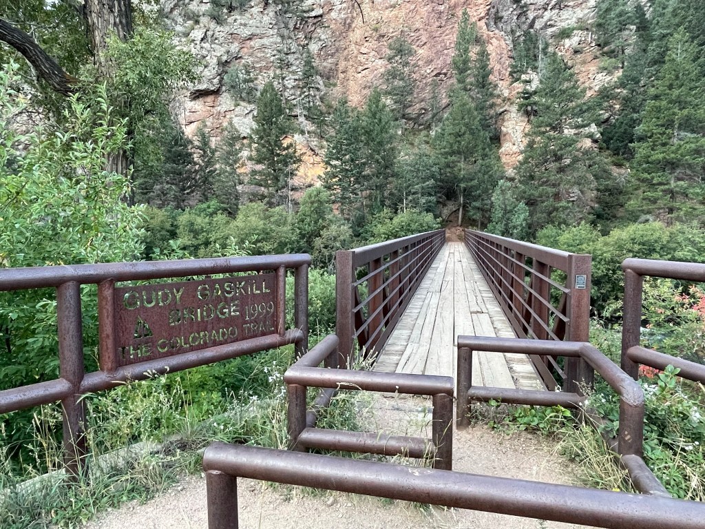
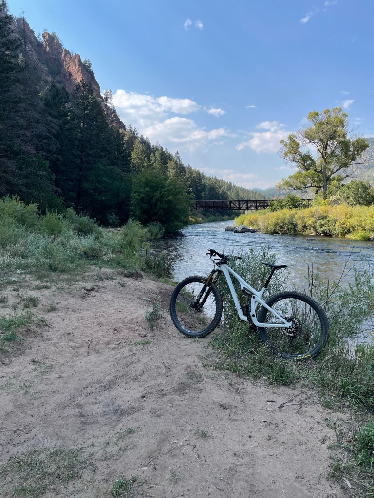
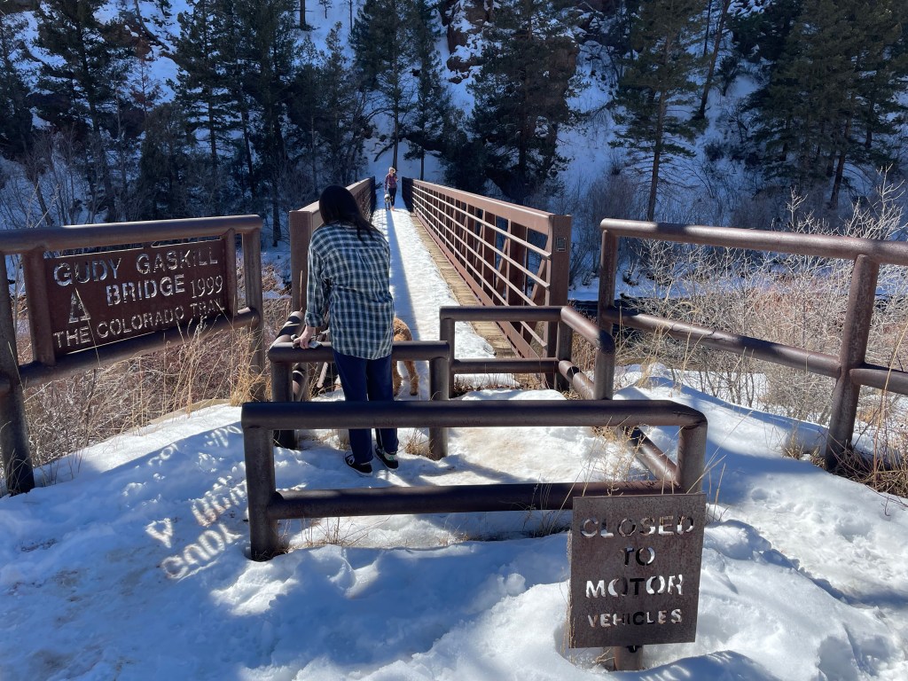
Judy Gaskill Bridge. Segment 2 starts by crossing the south fork of the South Platte River. The bridge is a steel truss pedestrian bridge. Super cool. When I finally returned to my starting point, I enjoyed hanging out beneath the bridge splashing cold river water over face, neck, arms and legs. I felt mighty positive vibes emanating from this bridge.
Now that’s a way-cool bridge!
What I Liked Least About Segment 2
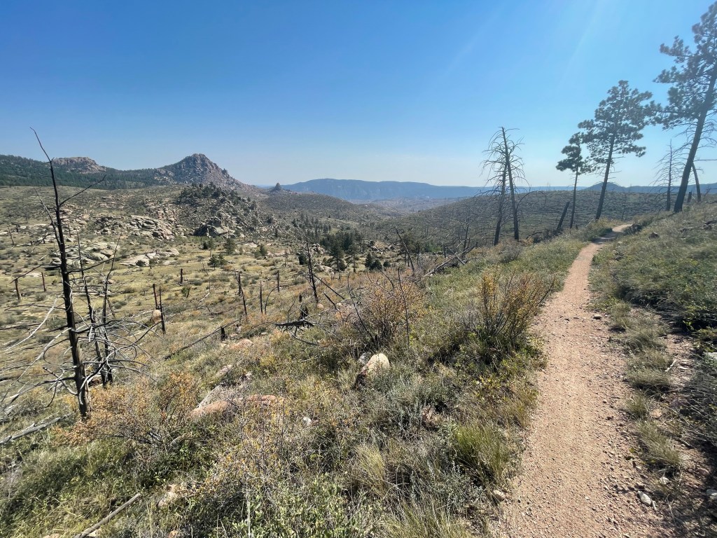
The trail itself is nearly 100% single-track, which sounds awesome for biking except the trail quality is very sandy and loose. Fine for hiking but more treacherous for biking. Even though most of the biking was downhill, it was not often comfortable because I was usually sliding in the loose dirt.
Loose trail. Sun coming up through the trees!
Biggest Learnings
Bring moleskin! Having this in my pack saved the day (or at least, saved my heel from a painful blister).
Slow down! Giving myself permission to take breaks, even on the bike ride, made a huge difference in the quality of my experience.
So, will I attempt another segment?
The romantic side of me says, Heck Yeah! That was amazing. The pragmatic side says, Heck No! That completely worked me. Between the heat, the distance, and the elevation, I’ll need at least a week to recover before attempting another segment. (wink)
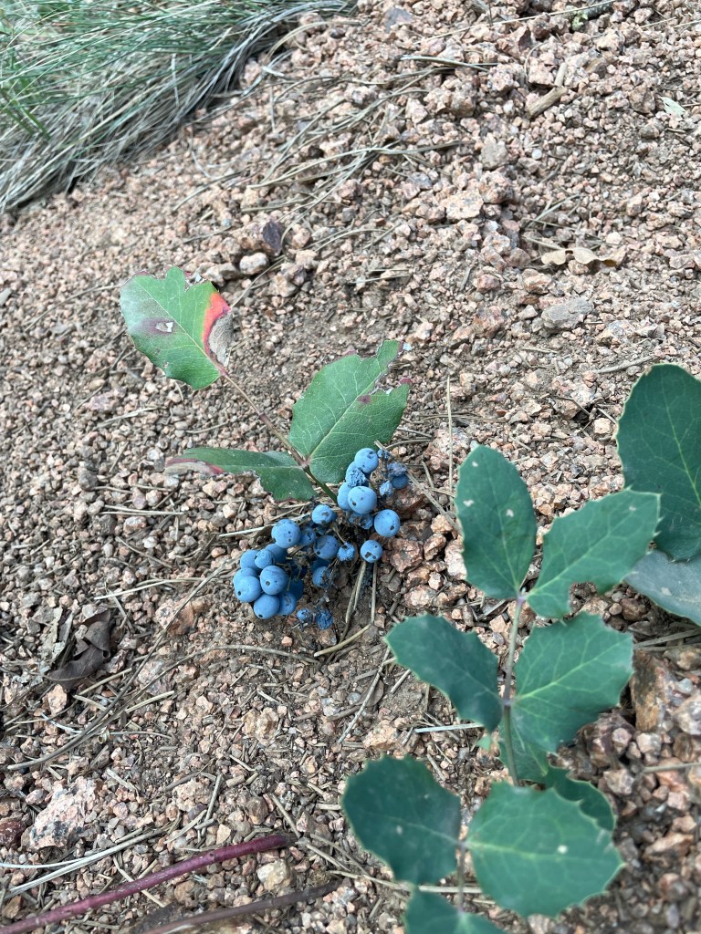
Looking downhill toward the riverBlueberries! (I wasn’t brave enough to try them.)Pink quartzAn old and abandoned quarry for pink quartzLoads of this quartz are all along the eastern section of Segment 2End of the bike ride. Glorious cool river water beneath the Judy Gaskill pedestrian bridge.Colorado Trail MarkerNo idea what these signs were warning me about.Crossed these roads around mile 6 of the hike, but the roads are closed to nearly all vehicles. (The signs look nice though.)Chair Rocks. No real views of this cool rock formation except from the CT.This was the approach to a neat rock outcrop. The tree center-left in the image protects a 4-ft wide gap between two giant boulders, and through the gap are great views of Chair Rocks.Burned treesThis whole landscape was denuded after the 1996 fire.More leftovers from the fireLoose trail, but nice to see some green pines in the lower section of that valley.My turn-around point. Little Scraggy marks the end of Segment 2 and the start of Segment 3.
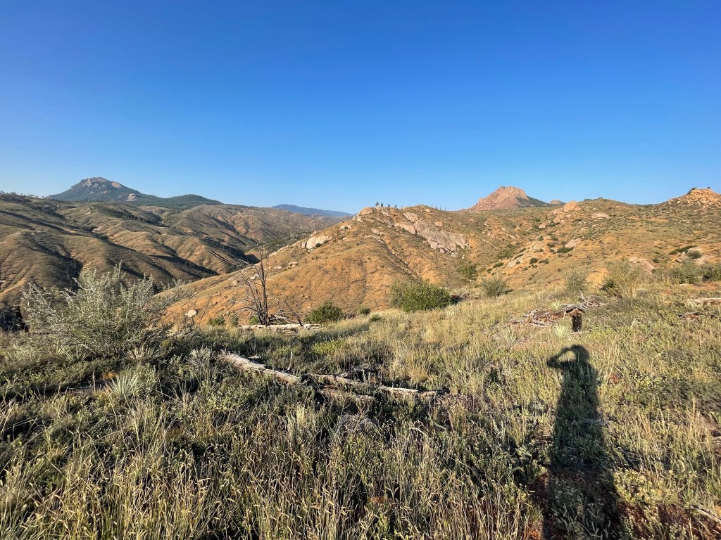
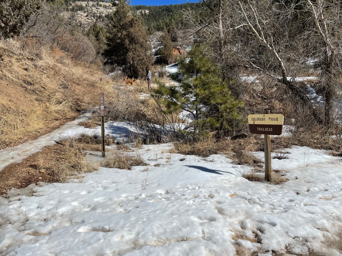
I got a first look at one of the transition points for the Colorado Trail Segment project. This is where the first segment comes out of the forest and crosses a dirt road to create a trailhead.
End of Segment 1. Feb 20, 2022
Platte River Road north of Deckers and east of Buffalo Creek is a dirt road that spectacularly follows the South Platte River. Fly fisherman can be seen standing in the water in their gaiters every hundred yards for miles. Despite being less than 2 hours from home this was my first time in this part of the state. The area is a gorgeous respite from crazy busy life with towering boulders sitting silent like giant’s play toys strewn haphazardly along the peaceful flowing river.
The second segment starts by crossing a footbridge over the South Platte river then heading left (south).
Quinn and Cricket on the near side of the foot bridge. The trail crosses the South Platte River then continues left (south) along the river.
The entire area is in Pike National Forest so camping is allowed (just not near the water). However, for this leg I learned during my scouting trip / mud run that I cannot leave my vehicle parked overnight back at the initial trailhead. Signs everywhere assured my truck will get towed. So for this first leg, it feels very much like I’ll need to do a same day out-and-back. What that probably looks like in terms of logistics:
Day 0 afternoon. Drive to the trailhead shown above, stash my mountain bike, a fresh bladder of water and some food in the forest. Then either find a campsite (there are several along the river, or find a flat spot in the forest) or drive back to Boulder to sleep.
Day 1. Break camp and head to the Segment 1 trailhead. Early start. 16 mile hike to my bike. Rest. Then bike 16 miles back to the truck. Drive home.
Elevation gain (hiking east-to-west): 2,830 ft
Elevation gain (biking west-to-east): 2,239 ft
The good news is there is a lot of downhill back to the truck on an easy well-groomed dirt road. It will nonetheless be a big physical day, and I’m not currently in shape for such a day, at least not yet. I need to figure out how much time it’ll take to hike 16 miles then bike back – how early do I need to start. Then there’s the food and water I’ll need. I also need to locate and study a topo map. I face a decision whether to get new boots (current pair is a year old and should be broken in but continues to cause blisters) or any other gear.
Prepping and training for Leg 1 will be a great initiation for this project!
The trailhead between segments 1 and 2 has a vault toilet and parking space for 20-25 cars.Information sign at this trailhead.It was a warm blue-sky day in February and we saw a few hikers enter or exit the trail. Since I also want to ride my bike, I’ll wait until it melts. There’s a CT marker on a tree.
In my weekly research I discovered the Continental Divide Trail and the Continental Divide Trail Coalition. Maybe 10 or 15 years ago I had heard rumors but had lost track, and it’s so exciting to see a continuous trail through the Rockies from Canada to Mexico!
Complete blazing of the trail was completed only recently in 2018! This is truly a brand-new trail, and it’s being viewed among big hiking circles as one of the big three, known collectively as the Triple Crown:
Appalachian Trail (AT) – 2,200 miles from Springer Mountain in Georgia to Mount Katahdin in Maine and travels through 14 states.
Pacific Crest Trail (PCT) – 2,650 miles from Campo, CA on the Mexican border to British Columbia through the states of California, Oregon and Washington.
Continental Divide Trail (CDT) – 3,028 miles from the border with Chihuahua, Mexico to the border with Alberta, Canada through the states of New Mexico, Colorado, Wyoming, Idaho and Montana.
The AT is the oldest and most traveled. Almost 2 million people hike a portion of the trail every year and there is a real thing called Trail Magic which refers to unexpected acts of generosity along the trail.
The PCT is also a well established and well maintained trail but it has fewer visitors than the AT. Trail Magic exists but is much less common because there is less density of people.
The CDT is the newest of the Triple Crown and it was planned, built and is maintained by a network of volunteers. The trail itself is more remote (further from roads and towns) than the AT and PCT and the route itself can become confusing in places as it traverses a maze of roads and trail alternates. The CDT has the least visitors of the three and Trail Magic never really has a chance to surface.
I am not looking at the Continental Divide Trail as a replacement or alternative for my segment-at-a-time Colorado Trail project. It’s far more remote, both in distance from my home and the trail itself is further from roads, meaning it’s really designed for through-hiking.
However, I see in the maps that the two trails coincide for several miles through the state of Colorado. Maybe in the future I can hit other parts of the CDT in other states. For now I’m excited to learn that it’s there.
Yesterday I had a few unexpected free hours and wanted to do a trail run. We’ve recently had a 8-9″ of snow and I love the trails under snow, so I geared up for cold and wore my studded shoes (short machine screws drilled into the rubber soles with the screw heads providing excellent traction on snow/ice).
With a little extra time available, I decided to drive south of Denver to the trailhead for the Colorado Trail. I ran 3.1 miles up the trail then back for a total of 6.2 miles (10k distance). The trail here is not really trail but a packed dirt road, and despite recent snow storms by the time I got there the road was unfortunately not snow-packed. The sun had done its duty and melted everything, leaving nothing but mud.
What could I do? I ran with my studded shoes in the mud.
With studded shoes it was better to run in the squishy mud on the left than the drier hard pack on the right
What I learned today:
1. Be prepared for any conditions, especially psychologically! I was disappointed and even a bit frustrated for a while, but then realized how much fun I was having in the mud. Conditions will undoubtedly be different than expected, at least part of the time.
2. The studs on my winter running shoes, intended for snow & ice, work very well in squishy mud. I did not slip once!
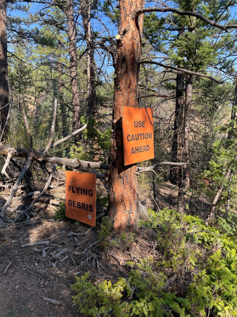
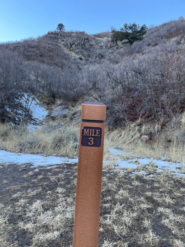
3. I liked these sign posts. I wonder how long they exist? I’m sure it’s not the entire 486 miles of the Colorado Trail.
Nice mile markers. According to signs these were donated by the Boy Scouts.
The plan I’m hatching does not include a continuous multi-week hike of the Colorado Trail. Instead, I want to tackle it one segment at a time.
The Colorado Trail is 486 miles and travels continuously from Denver to Durango, along or near the continental divide for much of the route, with 89,354 feet of elevation gain. The trail is broken into 28 segments based on where it crosses public roads thus creating trail access. Each segment is between 12-32 miles and 2,000-6,000 of gain.
I want to do a self-supported hike of every segment, and this is going to create some unique logistical challenges. For example, I plan to hike from east to west (Denver to Durango). What happens when I get to the end of a leg? Do I hike back to my truck, doubling my mileage? I’m definitely not up for that.
My idea is to drive ahead the day before and leave my mountain bike and some camping gear at the end of the leg. I can hike the leg one-way, find my stash and camp overnight, then re-stash the camping gear and ride my bike back the other direction.
I need to figure out when I’ll retrieve the camping stash. After I’m done biking? Or maybe just leave it until I tackle the next leg, which could be weeks or even months later.
Also how much total time will I need to complete a leg in this manner? For example if I leave my house in Boulder on a Saturday afternoon, I could drive to the end of the leg (could be 1-3 hours or more depending on the leg), drop off bike + camping gear, then drive around to the start of the leg (could be another 1-2 hours). Then camp at my truck overnight at the trailhead so I can get an early start hiking Sunday morning. Even the shorter legs of 12-16 miles will take me all day, so I’ll camp Sunday night, ride my bike back to the truck Monday morning, and drive back to Boulder Monday afternoon. Seems I’ll need at least a 48-hour window for every leg. Repeat this 28 times, and remember that the further I go the further each leg is from Boulder. That’s a lot of weekends and a lot of driving!
Plus some of the legs are LOOONNNGGGGG like 25-32 miles. Not sure I can hike that far in a day, so is there an option for ultralight backpacker camping? I’ve never done anything like that before, and it scares me a little.
I expect this will project require multiple years to complete. I probably can’t get started until I’ve got more free time than currently available in my life. I don’t want to be away from my kids so this will go into play in 2024 after my youngest finishes high school and heads to college. To accomplish this radical plan, I’ll also need to make some changes in my professional life. Not sure what that looks like yet but current work constraints are not compatible.
That’s all okay because there are clearly a lot of details to figure out in the meantime.
Beyond the overall lifestyle changes that will be necessary, I need to figure out how to train and what to pack. Since I’m planning mainly day trips, It’s great that I can essentially hike with a day pack instead of an overnight pack. That should protect my legs and back from repetitive use injuries carrying heavier loads. But I turn 50 next year and I’ll need to train for back-to-back hiking/mountain biking days.
Many people have hiked and biked the entire length of the Colorado Trail and their blogs and other published resources are filled with rich information. The Colorado Trail Foundation has a great guidebook. I’ll need to buy maps of the areas I’ll be visiting. I think I’ll also want to take a back-country orienteering course; such classes are offered by the Colorado Mountain Club.
The Colorado Trail is not as long as the Appalachian Trail or the Pacific Crest Trail, but it’s close to my home and it will be an epic adventure. I plan to post here as I research, plan and learn. And then continue to post when do it!
I’ve been running the trails of Boulder’s mountain parks for over 20 years. This week I was looking at a trail map and noticed a small loop that I’ve never been on before. I decided to check it out.
I parked my bike at the trailhead, strapped on my hydration belt and started off. About 2 miles in I found the trail turnoff (unmarked) and followed it steeply uphill. I was already riding the excitement of exploring something new when I passed another smaller trail shooting off on its own. It looked legitimate, but it was not on any maps. Should I go explore this unnamed trail or be satisfied with the pleasure of what I’d already found?
After a moment’s debate I took the unnamed trail, not knowing if it would dead-end or take me very far out of my way. It led to a beautiful hidden overlook and then a gigantic boulder in the forest. The trail never petered out and eventually I found myself connecting back to the well-known trail system. The detour added about 3/4 mile and the new trails formed a perfect loop back to the trailhead. Awesome!
Some of my favorite experiences are discovering new places, those hidden gems, and it’s all the more exciting when they have been hiding nearby all along. I suspect there are hidden gems everywhere if we’re open to looking for them.